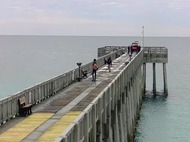
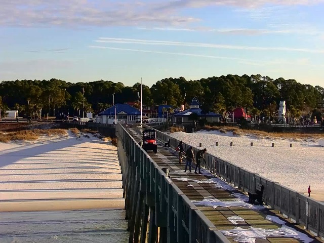
The pier remained closed Thursday due to lingering effects of Winter storm Enzo. Some of the roads and pier surface were still covered with snow. Friday morning, the pier maintenance crew spent several hours shoveling the remaining snow of the pier. It finally opened about 10:00 a.m. The storm didn’t affect the water clarity, which was fantastic, but the water temperature took a hit. We stayed below 60 degrees all seven days. This afternoon we warmed up to 58.5 degrees.
Fishing was tough and the catches were few. Species caught included Red Drum, Flounder, Whiting, Bonita, Bonnett Head Shark and Squid. Check the daily activity with the pitiful results of our week and the low numbers of fish.
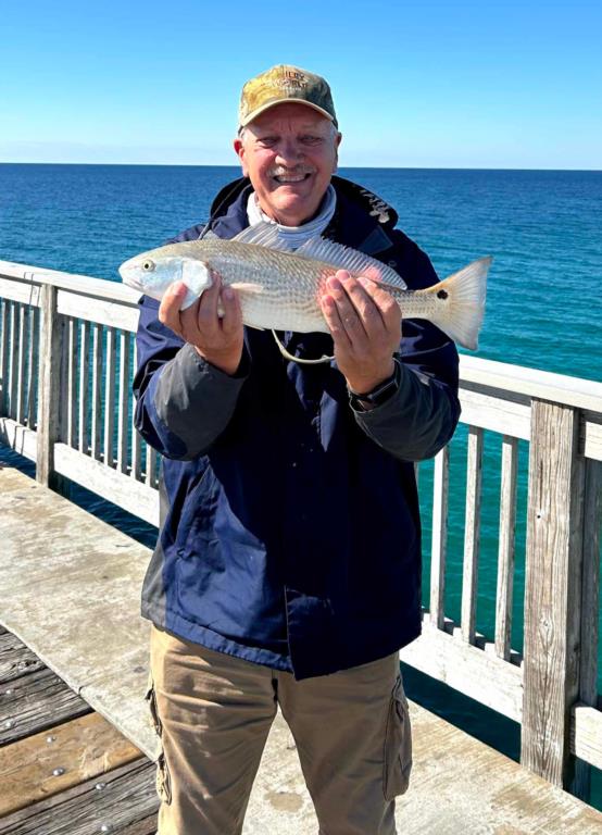
Several Red drum were hooked during the week with only one fish within the slot. Terry managed a 20-inch Red on Saturday.
Daily activity:
Thursday: water temp 53.4 – 55.2 Pier closed due to lingering effects of Winter storm Enzo.
Friday: water temp 53.4 – 55.8 Pier opened about 10:00am. One Red Drum hooked and lost.
Saturday: water temp 53.1 – 56.1 One slot Red Drum, one Flounder, a few Squid, a few small Bonita in pm.
Sunday: water temp 53.6 – 55.9 One Red Drum hooked and lost, a few Squid and a couple of Whiting.
Monday: water temp 56.1 – 57.4 Dead.
Tuesday: water temp.57.2 – 58.5 One under size Flounder, 2 Red Drum, several Bonnett Head Sharks.
Wednesday: water temp 57.6 – 58.5 one Flounder and a few Bonett Head Sharks.
In Northwest Florida over the past week, K. brevis was observed at very low concentrations offshore of Hernando County.
Tides Link
https://tides4fishing.com/us/florida-west-coast/panama-cityngin g
Full Moon Wednesday Feb. 12, 2025 New Moon Thursday Feb. 27, 2025 -
Tides for the upcoming week:
Sunrise: 6:33am Sunset: 5:18pm
Thursday 30th. 8:08am Low -0.7 10:39pm High 1.1
Friday 8:21am Low -0.5 11:33pm High 0.8
Saturday 8:16am Low -0.3
Sunday 7:40am Low 0.0 12:36am High 0.5
8:27pm Low 0.1 2:22pm High 0.3
Monday 5:59am Low 0.1 12:36am High 0.5
2:22pm High 0.3
Tuesday 1:07am Low -0.2 2:08pm High 0.8
Wednesday 05th. 2:20am Low -0.5 2:48pm High 1.0
Sunrise: 6:30am Sunset: 5:23pm CST
The Marine forecast for the next several days is:
THURSDAY
Southeast winds 10 to 15 knots. Seas 1 to 2 feet, building to 2 to 3 feet in the afternoon. Wave Detail: Southeast 2 feet at 3 seconds, becoming southeast 3 feet at 4 seconds. Protected waters a moderate chop.
THURSDAY NIGHT
Southeast winds 10 to 15 knots, becoming south 15 to 20 knots after midnight. Seas 2 to 4 feet. Wave Detail: South 4 feet at 5 seconds. Protected waters choppy. Patchy fog in the evening.
FRIDAY
South winds 15 to 20 knots. Seas 4 to 6 feet, occasionally to 8 feet. Wave Detail: South 5 feet at 6 seconds. Protected waters choppy. Patchy fog in the morning. A chance of showers in the afternoon.
FRIDAY NIGHT
Southwest winds 10 to 15 knots, becoming northwest after midnight. Seas 3 to 5 feet, occasionally to 6 feet. Wave Detail: South 4 feet at 7 seconds. Protected waters a moderate chop. A chance of showers.
SATURDAY
North winds 10 to 15 knots, diminishing to 5 to 10 knots in the afternoon. Seas 2 to 4 feet. Wave Detail: Southwest 3 feet at 7 seconds. Protected waters a moderate chop.
SATURDAY NIGHT
North winds 5 to 10 knots. Seas 2 to 3 feet. Protected waters a light chop.
SUNDAY
East winds 5 to 10 knots. Seas around 2 feet. Protected waters a light chop.
SUNDAY NIGHT
East winds around 5 knots. Seas around 2 feet in the evening, then 1 foot or less. Protected waters smooth.
MONDAY
East winds around 5 knots. Waves 1 foot or less. Protected waters smooth.
MONDAY NIGHT
East winds around 5 knots. Waves 1 foot or less. Protected waters smooth.
(local forecast).
THURSDAY (69/59 rain 09% wind SE-12)
FRIDAY (70/51 rain 81% wind SSW-17)
SATURDAY (68/50 rain 05% wind NNW-06)
SUNDAY (68/51 rain 05% wind SSE-04)
MONDAY (70/55 rain 07% wind SSE-05)
TUESDAY (70/58 rain 13% wind SSW-04)
WEDNESDAY(70/59 rain 08% wind SSE-06)
PIER MANAGEMENT CONTACT INFORMATION:
Bay County Parks and Recreation – 5304 Majetti Tower Road Panama City, FL 32404
850-248-8730
Vince Martin – Bay Co. Parks Division Manager - vmartin@baycountyfl.gov - 850-896-6580
Timothy Pentice- Bay Co. Asst. Div. Mgr. – tprentice@baycountyfl.gov – 448-217-4219
Tight lines and screaming drags,
Sam
SLP053@BELLSOUTH.NET
770-265-2879